Scenic Drives & Byways
Jaw-Dropping Drives in Western Colorado
Montrose is located in the center of some of the country’s most scenic and historic drives, making it the perfect home base for all kinds of day trips. There is never a wrong time of year to take in the amazing scenery while on a drive. Make sure you don’t forget your camera!
Use our online map to find your way or request a map at the Visitor Center or call 970-497-8558 and we’ll mail one to you.
Alpine Loop Backcountry Byway
Explore 65 miles of spectacular peaks and narrow glacial valleys, including 12,000-foot passes and well-preserved remains of stamp mills, tramways and ghost towns from the mining boom of the late 1800s. Portions of the route may be visited in normal passenger cars, but beyond these points, off-road vehicles must be used. The Alpine Loop also provides access to exceptional high-country hiking, fishing, mountain biking, camping, and other outdoor adventure. Download the Alpine Loop map
Bachelor Historic Loop
This 17 mile loop takes visitors through Creede’s unique silver mining district and two ghost town sites. The tour begins at the kiosk at the fork of East and West Willow Creek in the canyon north of town and ends at the kiosk on Highway 149 in Creede.
Grand Mesa Byway
This “playground in the sky” climbs from the rugged Plateau Canyon floor to the cool evergreen mesa forests 11,000 feet up. Featured are hundreds of sparkling lakes, blossoming wildflower meadows, and shimmering aspen and pine forests. Take a side trip to Lands End Overlook where the Grand Valley unfolds below.
San Juan Skyway
Travel the “road to the sky” which offers views of the towering 14,000-foot San Juan Mountains to rolling hillsides speckled with ancient Indian pueblo ruins. Victorian towns offer both excitement and relaxation. Soak in hot springs, ride the narrow-gauge railroad, and sleep under the stars or in a cozy lodge.
Silver Thread Scenic Byway
The colorful old mining camps of the Silver Thread offer history, beauty, and authenticity. The heights around Creede and Lake City remain strewn with abandoned mining structures, most of them accessible via rugged backcountry roads.
Trail of the Ancients
Explore the long and intriguing occupation of the Four Corners region by Native American peoples. Travel through the archaeological heartland of America while crossing the beautiful and diverse landscapes of the Colorado Plateau. World-renowned Mesa Verde National Park, Monument Valley Tribal Park, and Four Corners Monument are highlights on the trail.
Unaweep / Tabeguache Scenic & Historic Byway
A fabulous journey through history, geology, culture and nature awaits you on the Unaweep-Tabeguache Scenic and Historic Byway. Consisting of Highways 141 and 145, the vast scenery along this byway will keep you inspired along your journey. Visit the historic Driggs Mansion or the Hanging Flume and step back into history to a much simpler time.
West Elk Loop
The twin summits of Mount Sopris and the incomparable Black Canyon anchor the ends of the West Elk Loop. This magnificent landscape has been home to uncounted generations of Native Americans, most recently the Utes. White settlers originally came in search of minerals and stayed to farm and ranch. The coke ovens at Redstone bear witness to the toil that built the communities of today. Carbondale, Hotchkiss, Crawford, Gunnison, Crested Butte, and other towns offer a slice of Colorado’s rich history, varied lifestyles, and natural beauty. The route gives access to the White River and Gunnison National Forests, Black Canyon National Park, Curecanti National Recreational Area, and Crawford and Paonia State Parks.
Colorado National Monument
Colorado National Monument is a hidden gem near Grand Junction. Reached in about an hour from Montrose, this scenic drive has all sorts of options for hiking and scenic detours. If just sticking to the main road, visitors will see towering red rock formations, unique spires, and expansive desert views that stretch into Utah.
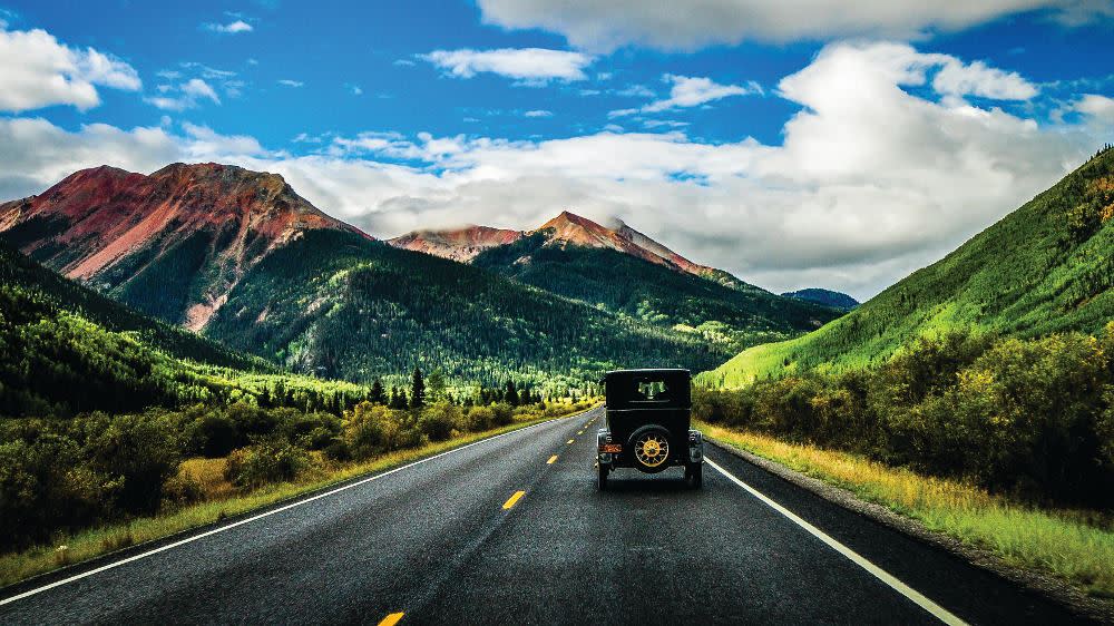
Million Dollar Highway
The Million Dollar Highway winds its way through the massive peaks and high mountain passes of the San Juan Mountains. Stretching from Ouray to Silverton, this drive is easily the most scenic in western Colorado. There are plenty of options for incredible hiking and off-road detours, some for high-clearance, 4WD vehicles only, including the famous Alpine Loop. Drivers be warned, this highway has many steep drop-offs and areas without guard rails.
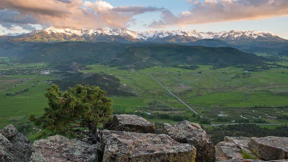
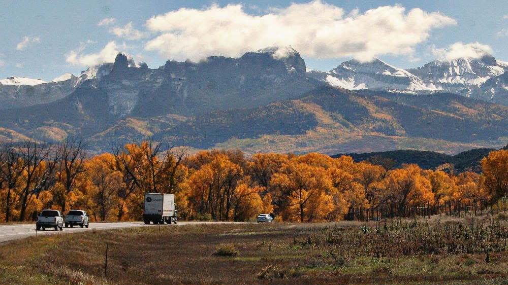
Dallas Divide to Telluride
Dallas Divide begins just a few miles west of Ridgway, CO, on State Highway 62. The high peaks of the Sneffels Range tower above the landscape, creating one of the most picturesque views the state has to offer. This is the perfect drive for those looking to spend the day in Telluride, or for those who are planning on traveling the entire Unaweep-Tabeguache Scenic Byway. Visitors can also drive a short distance past Telluride to Lizard Head Pass which features 360-degree mountain views and vast open meadows.
Silver Jack Loop
One of the area’s best-kept secrets is Silver Jack Reservoir. It can be reached by taking Cimarron Road, just past the town of Cimarron on US Highway 50, or by way of Owl Creek Pass near Ridgway via Ouray County Road 8. Exploring the complete loop is recommended as there are beautiful views expoloration-worthy points along the entire route. Short strays off of the main loop offer incredible scenery along the forks of the Cimarron River. Plan to spend all day on this loop as you will not want to leave.
Black Canyon National Park
Our most famous attraction, Black Canyon National Park can be reached in under half an hour from downtown Montrose via US Highway 50. The road along the canyon’s rim winds past breathtaking lookout points. For the best views of the canyon, including the famous Painted Wall, be sure to travel past the visitor center to the end of South Rim Road. Extend your drive and enjoy different perspectives of the park by taking East Portal Road to the canyon floor.
US 50 to Blue Mesa Reservoir and the North Rim of the Black Canyon
Highway 50 east of Montrose takes you through canyons and sprawling landscapes with mountain views until you reach Blue Mesa Reservoir, Colorado’s largest body of water. The dam can be reached in less than an hour, with the option to explore a portion of the West Elk Loop along State Highway 92 through Curecanti National Recreation Area to the North Rim of Black Canyon National Park and beyond.
Unaweep-Tabeguache Scenic Byway
This is one of the area’s longer, full-day scenic drives. This amazing scenic byway begins at the town of Whitewater, located 50 miles northwest of Montrose on US Highway 50, This byway passes through the beautiful Unaweep Canyon, to the red rock desert of Gateway, Colorado, and by the famous “Hanging Flume” until reaching the old uranium mining towns of Uravan and Naturita. If you make a full loop back to Montrose, you will traverse the beautiful Dallas Divide which has some of the most photographed views of Mount Sneffels.
Dave Wood Road to Divide Road
Dave Wood Road is a very short drive from downtown Montrose and offers some of the best recreation on the Uncompahgre Plateau. The plateau is full of backroads, hidden waterfalls, secret trails, and offroading adventures amongst sandstone canyons and vast forests. Choose to do a quick trip or spend an entire day on the plateau.
Grand Mesa
Grand Mesa, the largest flat-top mountain in the world, features over 300 lakes, an array of recreational opportunities, and amazing views throughout. Take a quick drive over the mesa via US Route 65, also known at the Grand Mesa Scenic Byway, or chose from numerous off-route options to extend your excursion. One such route to the Lands End Observatory rewards the adventurous with remarkable views of the valley floor thousands of feet below. If your are looking for a nice place to combine a scenic drive and a relaxing picnic, this would be the perfect choice!
Rimrocker Trail
The Rimrocker Trail is one of the most popular overlanding trails in the country. The trail’s 160 miles of dirt road stretch from Montrose all the way to Moab, Utah. This trip, which crosses very remote terrain with no services, is usually done over several days and requires good planning for fuel and supplies. Choose to drive the trail end-to-end or plan to do only a portion and loop back to Montrose. Maps and information can be found at the Montrose Visitor Center. (All day or multiple days)
Peach Valley
Peach Valley is just a stone’s throw from Montrose and has some very unique scenery. The Mancos Shale hills known as the “adobes” hold lots of recreation opportunities and feature many hidden dirt road adventures. Although most roads are for high clearance vehicles only, the main Peach Valley Road is well maintained and almost any vehicle can explore around the base of the unique adobes.
West Elk Loop
The West Elk Loop is another of Colorado’s impressive scenic byways. As with most scenic drives, it can be done in shorter segments or as a full loop. The byway passes through Curecanti National Recreation Area, Gunnison, Crested Butte, Kebler Pass, Marble, Redstone Carbondale, McClure Pass, Paonia, the North Rim of the Black Canyon National Park, Crawford, and more. Visitors will experience many different types of beautiful landscapes throughout this drive. This is one drive you won’t forget!
Last Dollar Road
Last Dollar Road stretches from Dallas Divide, near Ridgway, to Telluride. This scenic dirt road features some outstanding views of the Sneffels Range as well as some of the most beautiful ranches and homes in the country. This route requires a high clearance vehicle for the majority of the way and is mostly surrounded by private property. At the top, you will find the best views available of the Wilson Range near Telluride and some excellent hiking opportunities as well. Peak wildflower and leaf peeping seasons are the best time to take this drive.